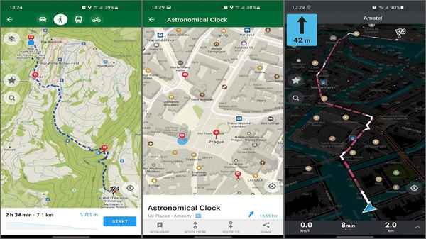
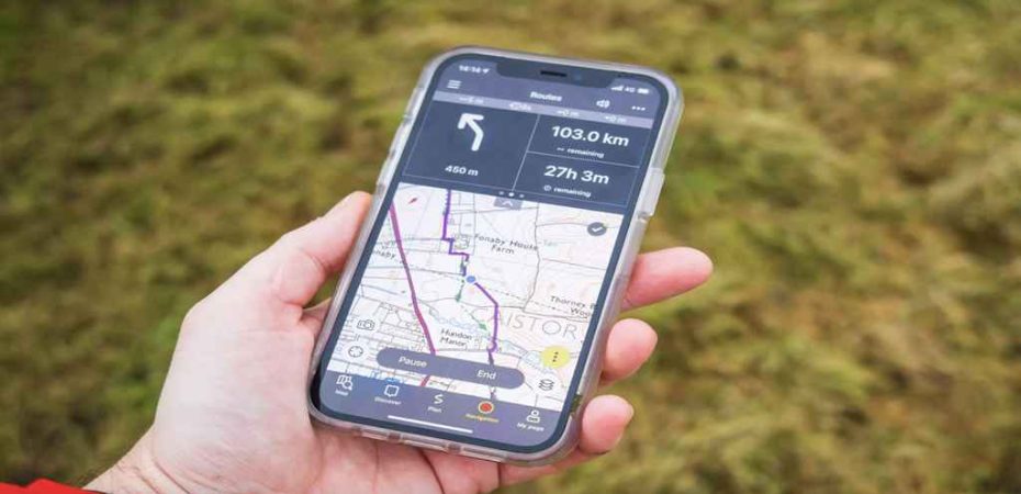
Hiking, once considered a traditional activity reliant on maps and compasses, has seamlessly integrated with modern technology through the advent of mobile applications. These apps have revolutionized the hiking experience, providing a plethora of features and innovations to enhance trail navigation. Mobile apps have become indispensable tools for hikers worldwide, from real-time GPS tracking to crowd-sourced information on trails. In this article, we’ll explore the key features and innovations in trail navigation offered by mobile apps tailored for outdoor enthusiasts.
GPS Tracking and Offline Maps

One of the fundamental features of hiking apps is GPS tracking coupled with offline maps. These apps utilize smartphones’ GPS capabilities to pinpoint the user’s location, even in remote areas with no cellular coverage. By pre-downloading maps, hikers can navigate trails like Tour du Mont Blanc without worrying about connectivity issues. Moreover, GPS tracking allows users to track their progress, estimate distances, and plan routes effectively.
Trail Information and Reviews
Mobile apps provide comprehensive information about hiking trails, including difficulty levels, elevation profiles, trail conditions, and nearby points of interest. Users can access detailed descriptions and reviews shared by fellow hikers, offering valuable insights into the trail’s suitability and scenic attractions. This crowd-sourced information helps hikers make informed decisions and discover hidden gems in unfamiliar territories.
Safety Features
Safety is paramount in outdoor activities, and hiking apps incorporate various features to ensure hikers’ well-being. These include real-time weather updates, emergency contact integration, and SOS functionalities. Some apps allow users to share their location with friends or family members, providing peace of mind during solo expeditions. Additionally, certain apps offer tips on wilderness survival and first aid procedures, equipping hikers with essential knowledge for emergencies.
Augmented Reality (AR) Navigation
Augmented Reality technology has been integrated into hiking apps to offer an immersive navigation experience. By overlaying digital information onto the real-world environment through the smartphone camera, AR navigation guides users along trails with visual cues and waypoints. This interactive feature enhances navigation accuracy and engagement, especially in complex terrains or poorly marked trails.
Trail Recording and Social Sharing
Many hiking apps allow users to record their hiking adventures, capturing essential data such as distance traveled, elevation gain, and duration. These recorded tracks can be saved for personal reference or shared on social media platforms to inspire and connect with other outdoor enthusiasts. Some apps offer features for creating and joining hiking challenges or events, fostering a vibrant community of like-minded individuals.
Environmental Awareness and Conservation

In line with the growing emphasis on environmental sustainability, several hiking apps promote responsible outdoor practices and conservation efforts. They provide information on Leave No Trace principles, trail etiquette, and eco-friendly hiking tips. Furthermore, some apps collaborate with environmental organizations to raise awareness about local ecosystems, wildlife conservation, and trail maintenance initiatives.
Top 3 Modern Mobile Apps For Hikers
Here are 3 mobile apps with awesome innovations in trail navigation.
Outdoor Navigation
Outdoor Navigation is one of the most popular applications for hikers. It provides detailed maps with different layers of information (topographic map, satellite images, weather data, etc.), as well as a GPS navigation function with the ability to record routes and track your location in real time.
OfflineMaps+&Navi
OfflineMaps+&Navi is a great app that allows you to download maps and use them offline. This way, you can be sure that you won’t get lost even in remote places with no cell phone signal. The app also supports GPS navigation and has many useful features, including finding food and lodging locations.
Komoot
Komoot is a great app for planning routes in the mountains and on hiking trails. It offers detailed maps that include information about the difficulty of the route, recommended times to tackle it, and exciting points of interest along the way. With a combination of GPS navigation and route information, you’ll always know where you are and where you’re going.
Conclusion
Mobile apps have transformed the way hikers navigate trails, offering a wide array of features and innovations to enhance the outdoor experience. From GPS tracking and offline maps to augmented reality navigation and environmental awareness, these apps cater to the diverse needs of outdoor enthusiasts while promoting safety, community engagement, and environmental stewardship. As technology continues to advance, we can expect further developments in trail navigation apps, empowering hikers to explore the great outdoors with confidence and convenience.
Read Also:
- The Complete Guide to Fix OBS Studio NVENC Errors
- Stuck on “Please Wait for the GPSVC”? Here’s What to Do
- Garmin Dash Cam 67W Review
- AirTags For Android: The Best Alternatives
- 5 Commercial Applications Of Drone Technology
- 5 Ways To Fix ‘Life360 App Not Working’ Properly
- Fix ‘Facebook Dating Location Not Working’ Problem
- 3 Ways Technology Makes it Easier to Find Your Perfect Engagement Ring


